Askari 10
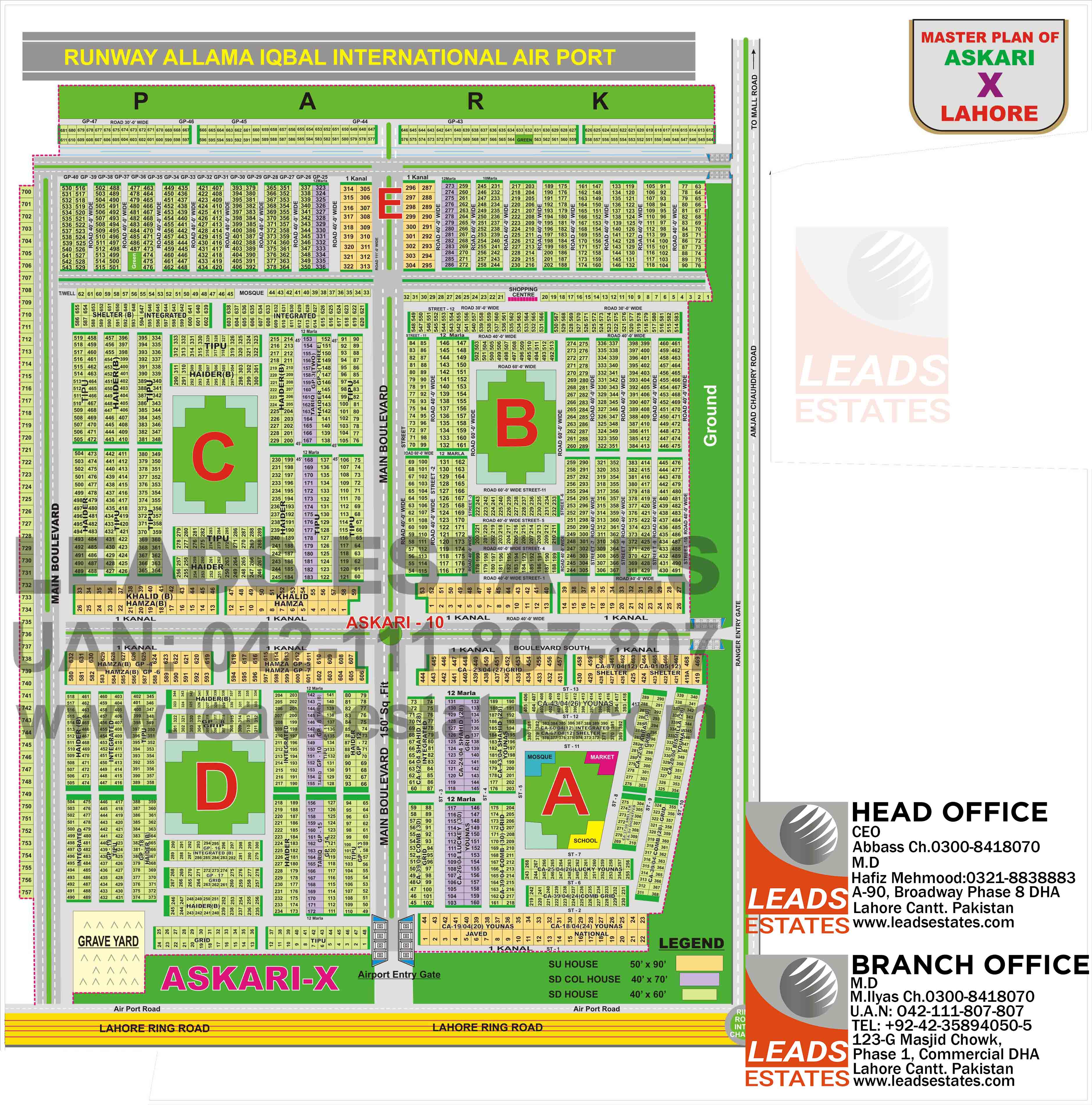
Askari 10 is a master-planned residential society situated in a prime location. Some of the major connecting roads of Askari 10 Lahore consist of Airport road and Amjad Chaudhry Road. The map of Askari 10 Lahore shows the nearby significant housing societies consist of Saddar Town LAHORE, Raza Park housing society Lahore, Allama Iqbal International Airport, Royal Garrison Enclave Housing Society.
Askari 10 has five sectors A, B, C, D, and E.
There are several types of properties, such as houses, flats, and, Plots.Askari housing society is famous among Pakistan army officers and their families. There are Eleven Pharmacy in Sector A. CSD Departmental store is also situated in Sector A.Furthermore, there is a Hasnah Shopping Complex in Sector B. It takes a 15 to 20 drive to reach Green valley supermarket in the Mall of Lahore and Carrefour. Almost every sector has its very own mosque. Some well-reputed schools are found near the Askari 10, such as The City School, LGS, Beaconhouse, and The Broadway School. It takes 15 to 18 minutes to reach this school.
The University of South Asia is also near Askari 10 Lahore. The university is placed at a stretch a few Km away. Easy access to hospitals by following the map of Askari 10 Lahore. Some Parks are positioned in Society.
Use Askari 10 Lahore map to know more about Society. Famous landmarks near Askari hosing Society are Shalimar Bagh. It takes approximately 21 minutes to Reach Askari 10.
